


Lake Managua
Lake Managua is one of the main lakes and physical features of Nicaragua. Lake Managua is located in western Nicaragua in a rift valley. It has an elevation of 128 feet (39 meters) above sea level. It has a depth of 65 feet (20 meters), is 36 miles (58 km) from east to west, 16 miles (25 km) from north to south and its area is 400 square miles (1,035 square km). Lake Mangua’s Indian name is Xolotlán. The lake is fed by numerous streams rising in the central highlands and the Diriamba Highlands. It is drained by the Tipitapa River, which flows into Lake Nicaragua. Its waters have fish and alligators and are plied by shallow-draft vessels. The rains caused by Hurricane Mitch in 1998 Went over Lake Managua causing the lake to overflow. This hurricane did not just make Lake Managua overflow but it hurt several of the poorest communities in the area.
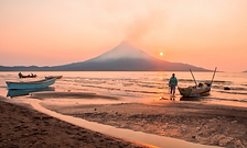

Lake Managua at sunset
Citations
-
Lake Managua | Nicaragua, Map, Location, & Facts
By TheContainer: Encyclopedia BritannicaYear: 1998URL: https://www.britannica.com/place/Lake-Managua